Sunday, 7 July 2013

B - list of geographical terms and definitions

B
Back Wall: Back wall is the steep cliff at the rear of a corrie.
Background Extinction: Background extinction refers to the extinction of species on the Earth due to changes in the environmental conditions.
Backshore: The area, behind the shore that is untouched by water is known as backshore. It an extension of the beach, between the beach berm and backshore slope.
Backwash: Backwash is a backward movement of water from the shore, once it has washed the run up of the beach.
Backwash: the return of water to the sea after waves break on a beach.
Backwater: Backwater is defined as a water body formed due to an obstruction in drainage.
Badlands: Very irregular topography resulting from wind and water erosion of sedimentary rock.
Bahada: In geography terms, a bahada is a gently sloping plain, at the foot of the mountains. This slope is created by descending streams. A bahada is generally seen when several alluvial fans fuse together.
Balance of Trade: the value of exports minus the value of imports; there may be a trade deficit or tradesurplus.
Bankfull Discharge: It is the maximum discharge made by a river without flooding.
Bar Chart: Bar chart is a graphical representation of various amounts or frequencies. These items are shown with variations in lengths.
Bar: A bank of sand near the mouth of river.
Bar: where a spit grows across a bay. A bar can eventually enclose the bay to create a lagoon.
Barchan: Barchan is an exact crescent shaped sand dune made by the winds. The crescent tips point downwind, which move fast due to wind movements. The wind brushes the sand on the windward side which collapses on the leeward making the barchan sand dunes to move forward.
Barrage: A barrage is defined as a barrier in a watercourse to divert it or to increase the depth of the water.
Barrier Beach: A bar shaped sand or a low-lying coral island, which is parallel to the coastline but slightly away from it is called a barrier beach.
Basal Sapping: In geographical terms, basal sapping means erosion at the foot of a slope caused by chemical erosion usually in tropical areas.
Basalt: Basalt is an igneous rock. This fine grained rock is formed when erupted lava cools down rapidly under water.
Base Flow: Groundwater seepage, which flows into streams is known as base flow.
Base Level: The lowest level at which the erosion can take place is known as the base level.
Base level: The lowest level to which a stream can erode its bed. The ultimate base level of all streams is, of course, the sea.
Base Level: the mouth of the river and the point where the gradient becomes zero. No further erosion is possible during normal river flow at this point.
Basic Volcano: Basic volcano is when hot lava, having low viscosity erupts from the vent and cools down to form a shallow conical mountain surface.
Bathysphere: Inner portion of the earth.
Battery Farming: The latest geography term, battery farming is a cost-effective method of farming used to reduce the per unit cost. The cattle are reared in cages and are watered and fed automatically.
Bay: As per geography definitions, a bay is a water body that surrounds a crescent-shaped coast line or a piece of land. For example, the Bay of Bengal on the eastern coast of India. It is larger than a cove but smaller than gulf.
Bays: found between headlands where there are alternating outcrops of resistant (harder) rock and less resistant (softer) rock. Waves erode the areas of softer rock more rapidly to form bays. The more resistant, harder rock forms the headlands that protrude out to sea.
Beach Depletion: Loss of sand and shingles from the beach due to low replenishment and rising sea levels and longshore drift is called beach depletion.
Beach Depletion: the loss of beach material e.g. by offshore dredging of shingle banks.
Beach Replenishment: the addition of new material to a beach naturally, through the action of longshore drift or artificially, through the dumping of large amounts of material.
Beach: In geography terminology a beach is accumulation of sand and shingles along a water body due to sedimentation.
Beach: the temporary deposition of sand and shingle along the coastline. Without its beach a coast is vulnerable to erosion, e.g. the cliffs at Barton on Sea were easily eroded following the construction of a groyne updrift at Bournemouth.
Beaufort Scale: Beaufort scale is a measure used to describe the speed of wind on the basis of observations of the sea conditions. This is an empirical instrument created in 1805 by Sir Francis Beaufort.
Bed Load: In geography terms list, bed load describes the flowing particles that are transported along the river bed with the currents. A bed load movements are rolling, sliding, traction and saltation.
Bedding Plane: Bedding planes are boundaries that define the layers or strata of a sedimentary rock.
Bedding Plane: a line in rocks separating two different layers: one usually more resistant to erosion, one usually weaker. The layers, deposited horizontally millions of years ago as sediment on the sea bed, have often been tilted through earth movements (tectonics), creating an angle of dip.
Bedload: the material carried by a river by being bounced or rolled along its bed.
Bedrock: In geographical terms, a bedrock is a consolidated rock form beneath the surface of the earth.
Bedrock: The solid rock that underlies all soil or other loose material; the rock material that breaks down eventually to form soil.
Benthos: Benthos are the marine organisms that live near, in or on the seabed. In geography terms, these regions are called the benthic zone.
Bergeron-Findeisen Process: Bergeron-Findeisen process is the process of rain formation. It is the formation of cold rain or ice crystal in the cold clouds of the mid and higher latitudes of the atmosphere.
Bergschrund: a deep crevasse found at the back wall of a cirque, formed as the ice moves away downhill. This may have an important role in the processes leading to the deep erosion of the cirque basin.
Biodiversity: The diversity of species found in a particular area. It includes the variety of flora and fauna in the given ecosystem.
Biofuel: Substances such as gas, alcohol and long dead biological material constitute biofuel. Use of organic materials makes biofuel different from fossil fuels.
Biogas: Biogas in geography glossary of terms and definitions is defined as a type of biofuel produced from decomposition of organic matter without oxygen.
Biogeography: Biogeography is included in the geography terms, because it studies the distribution of animals and plants on the planet.
Biological Control: Biological control is a natural way of controlling weeds and pests in agriculture.
Biological diversity: A concept recognizing the variety of life forms in an area of the Earth and the ecological interdependence of these life forms.
Biological Weathering: the breakdown of rock through the action of plants and animals.
Biomass is a conventional and renewable source of energy. This energy is generated from dead organic or living organic materials such as wood and plants. Read more on biomass energy.
Biomass is defined as the living matter and biological organisms in a particular area's ecosystem at a given time.
Biomass: Biomass can be defined in two ways:
Biome: Biome are areas with similar climatic conditions, similar ecology of plants, animals and soil organisms. There are commonly known as ecosystems.
Biomonitoring: Biomonitoring is a detailed observation of an ecosystem to monitor, understand and record changes.
Biosphere: Biosphere is a total of plant life, animal life and all other factors that make up the earth.
Biosphere: Biosphere is the sum total of the ecosystems present in the world. In other words, biosphere is a global integration of all living beings, their interactions, interdependence and relationships.
Biosphere: The realm of all living things.
Biota: Biota is the collection of a wide range of plant and animal life of a geographic region.
Biotechnology: Biotechnology is a technology, which uses biology, agriculture, food science and medicine for research and development in the field of pharmacy.
Biotic Factors: Biotic factors are all living organisms of an ecosystem. It is the effect of one living organism on another, which include animals, plants, humans and aquatic flora and fauna.
Biotope: Biotope is an area with uniform climatic conditions, conducive to specific plants and animals. The meaning of biotope is similar to habitat.
Birth Rate: The number of live births per 1000 people per year.
Birth Rate: The number of people being born for each 1,000 of the population.
Blizzard: A blizzard is a torrential winter storm having very low temperatures, strong winds and heavy snow.
Blowout Depression: Blowout depressions are formed in sandy areas due to erosion of sediments by winds.
Bore: A high tide running up a river.
Boulder Clay: an unsorted mixture of sand, clay and boulders carried by a glacier and deposited as ground moraine over a large area. Now regarded as an obsolete term.
Brackish: Brackish water has more salinity than freshwater. But the salinity is less than the sea water.
Break of Bulk Point: the place where goods have to be unloaded e.g. a port.
Break of Bulk Location: a location such as a coastal port which takes its advantage from a position where there is a forced transfer of raw materials or goods from one form of transport to another. Coastal locations are favoured for iron and steel plants in the UK since the coal and iron ore raw materials are now imported.
Breaker: Breakers are reefs against which sea waves break.
Breakwaters: offshore coastal defence structures built of stone parallel to the coastline; they help absorb the energy of breaking waves. Deposition occurs in the calmer water created behind the breakwater.
Bridging Point: a settlement site where a river is narrow or shallow enough to be bridged. The bridge becomes a route centre and trading centre, the natural location for a market. It is also a good defensive site. The lowest bridging point on a river is the bridge nearest to the sea; this site is ideal for a river port settlement.
Bridging Point: An easy crossing point where the river narrows or is shallower.
Brook: Brook is a small stream that flows with gravity. It is smaller than a creek.
Brown Earth: It is a type of soil that is found in European deciduous woodland areas.
Brownfield land: urban land that has previously been developed, such as a the site of a demolished building or factory.
Brownfield Site: an inner-city derelict site which can be cleared and reused for new industry.
Bulge of Young Male Migrants: on a population pyramid; young males move to urban areas due to push-pull factors.
Burgess Model: an urban land use model showing five concentric zones, based upon age of houses and wealth of their inhabitants. (See concentric ring model).
Business Park: New offices built in pleasant surroundings on the edge of cities.
Business Parks: these are mainly found on edge-of-city greenfield sites, although some are part of inner city redevelopment schemes. Usually over 70% of the land is converted into ornamental gardens and lakes. They are ideal locations for high-tech industries such as electronics and research institutions.
Buying in Bulk: negotiating low prices from the supplier by offering to buy very large quantities of a particular product.
By-pass: A road built around a busy urban area to avoid traffic jams.
By-products: what is left over after something is made e.g. chemicals following the refining of oil. Some by-products can be treated to make other products.


Thursday, 30 May 2013

A - list of geographical terms and definitions

A
Abiotic: All the non-living things, which comprise the environment are known as abiotic factors. Rock, water, mountains are all examples of abiotic elements of environment.
Ablation: The geographical term, ablation is defined as the net loss of water from the glacier due to melting, evaporation, sublimation, and calving.
Abrasion: Abrasion is the degeneration of land due to 'scouring action of materials'.
Abrasion: erosion caused by rocks and boulders in the base of the glacier acting like a giant file scratching and scraping the rocks below.
Abrasion: the pebbles being transported wear away the bed and banks of the river channel.
Abrasion: wearing away of cliffs by sediment flung by breaking waves. See Corrasion.
Absentee Landlords: land owners who live away from their estate, often in an urban area. They take rent from their tenant farmers but may make little contribution in return. (See Tenant Farmer).
Absolute Humidity: Absolute humidity is determined by content of water vapor in the air (grams) per cubic meter.
Absolute Location: An absolute location of a place is defined by longitude and latitude on the earth's surface.
Absorption: Absorption is defined as the permeation of one substance into another. For example, the land absorbs the rain and increases the ground water level.
Abyssal Plain: Abyssal plain is a large flat area of the ocean, generally 5,000-6,000 m below sea level.
Accessibility: A locational characteristic that permits a place to be reached by the efforts of those at other places.
Accessibility: How easy a place is to get to.
Accessibility: The ease or difficulty associated with reaching a location or a destination is known as accessibility.
Accessible: A place which is easy to reach.
Acculturation: A change or a modification in a culture due to adoption of new principles, customs, trends and traits is known by the term acculturation.
Acid Lava: Lava which contains high levels of silica is known as acid lava. Acid lava has high viscosity and high melting points.
Acid Rain: A commonly used geography term, acid rain is highly acidic due to sulfuric and nitric acids created by human pollution and burning of fossil fuels.
Acid rain: Rain that has become more acidic than normal (a pH below 5.0) as certain oxides present as airborne pollutants are absorbed by the water droplets. The term is often applied generically to all acidic precipitation.
Active volcano: A volcano that is currently erupting, or has erupted during recorded history.
Active Volcano: A volcano that has erupted recently and is likely to erupt again.
Adiabatic cooling/heating The rate of cooling (by expansion) as an air parcel rises. It is approximately 1 degrees Celsius per 100 metres. It is also the rate of heating (by compression) as an air parcel descends.
Aeolian: This geography term is derived from the Greek God of Winds, Aeolus. Aeolian refers to the erosion caused by winds or that is related to winds.
Aerial Photograph: Aerial photograph is photography done from above the surface of the earth. These photographs help in providing an aerial (birdlike) view of a geographical terrain.
Aerosol: Fine liquid or solid particles suspended in the atmosphere. Aerosols resulting from volcanic eruptions are tiny droplets of sulfuric acid—sulfur dioxide that has picked up oxygen and water.
Afforestation: Afforestation refers to planting trees on barren lands and also in other deforested areas.
Aftershock: Aftershock is defined as the tremors that are felt after a major earthquake, from the epicenter.
Ageing Population Structure: a population pyramid with a narrower shape, broad at the top, found in MEDCs. This reflects their low birth rates and the greater proportion of elderly people.
Ageing Population: In the population structure of many MEDCs there is often a high proportion of elderly people who have survived due to advances in nutrition and medical care. This creates problems since these people do not work and have to be provided with pensions, medical care, social support, sheltered housing etc. from the taxes paid by a proportionally smaller number of workers. In addition, an increasing number of young people are employed as care workers for the elderly. This removes them from more productive jobs within the economy and harms a country's competitiveness.
Age-Sex Pyramid (Population Pyramid): a series of horizontal bars that illustrate the structure of a population. The horizontal bars represent different age categories, which are placed on either side of a central vertical axis. Males are to the left of the axis, females to the right.
Age-sex Pyramid: Age-sex pyramid is also known as the population pyramid. This geographical term is a graph, which gives the age and sex distribution of a population.
Agglomeration Economies: savings which arise from the concentration of industries in urban areas and their location close to linked activities. e.g. A car factory attracts component suppliers to locate close by, saving on transport costs. Other savings are made in labour and training costs, and the use of the services found in urban areas, e.g. housing, banking, roads, electricity, etc.
Agglomeration: a group of industries in the same location.
Agribusiness: large-scale capital-intensive, commercial farming.
Agricultural: to do with farming. The work of growing crops or rearing animals.
Agriculture: Agriculture is the science and business of growing crops, breeding livestock and cultivating soil.
Agriculture: The growing of crops and rearing of animals.
Aid: the giving of resources by one country or organisation, to another country.
Air mass A large body of air that has similar temperature, pressure and moisture properties.
Air mass: A very large body of atmosphere defined by essentially similar horizontal air temperatures. Moisture conditions are also usually similar throughout the mass. (IIP 2008)
Air Pressure: Air pressure is the force that the air exerts on the surface.
Albedo: The amount of sun's rays that is reflected by an earthly body is called albedo. It is the reflection of a certain area of earth, like snow and mountains, on the surface. For example, the albedo of snow covered mountains hurts the eyes.
Alluvia: Clay, silt, gravel, or similar detrital material deposited by running water.
Alluvial Fan: Alluvial Fan is a fan-shaped soil deposit formed due to sediments. This is usually found at the foot of the valley, where a stream fans out and deposits the sediments of the stream.
Alluvial soils: Soils deposited through the action of moving water. These soils lack horizons and are usually highly fertile.
Alluvium: Alluvium are deposits made by rivers. These are found near floodplains or at point-bars.
Alluvium: rock particles (clay, silt, sand and gravel) deposited by a river.
Altitude: Altitude is the vertical height above the sea level.
Altitude: Height of an object in the atmosphere above sea level.
Amalgamated Farms: small farms joined together to form one large agricultural unit. (See Economies of Scale).
Amenities: services that people find very useful, but are not essential, like swimming pools, libraries, parks, etc..
Amenities: These may be within the home, in which case they refer to baths, toilets (w.c.'s), hot water etc., or outside people's homes in which case they would include parks, shops, public transport provision, etc..
Angle of Dip: the angle of the bedding planes which affects the shape of the cliff. If the rock layers are horizontal, small overhangs of more resistant rock form in the cliff face. If the bedding planes dip towards the sea, a gently sloping cliff face is formed with few overhangs. If the bedding planes dip away from the sea, a steep cliff face with many large overhangs of more resistant rock is formed.
Angle of Response: Angle of response is the maximum angle that a slope attains and at which it remains stable. It may be a pile of rocks or any granular pile. It is caused due to friction and cohesion.
Angular Rock: a rock with sharp edges.
Anticyclone High pressure system in which air descends to give calm conditions and clear skies. Associated with summer heatwaves and winter frosts and fogs.
Anticyclone: As per geography definitions, anticyclone is a stable air mass, which produces high pressure and warm conditions.
Anticyclones: A region of high atmospheric pressure surrounded by low atmospheric pressure.
Antipode: The exact opposite point on the surface of the earth to any other given point is known as antipode. For example, south and north poles are considered as antipodes of each other.
Aphelion: Aphelion is the point of time when the earth is farthest from the Sun, while it is revolving in the orbit. This occurs around July 3, when the earth is approximately 94,555,000 miles away from the Sun.
Appropriate Technology: technology suited to the area where it is used. It usually refers to simple, low-cost machinery. (See Intermediate Technology).
Aquatic Fauna: In the geography glossary, aquatic fauna is defined as the animal species living under and in water.
Aquatic Plants: In the geography glossary, aquatic plants are defined as all the plants living and reproducing in the water.
Aquifer: Aquifer is a water reserve in the Earth's belly. In other words, it is an underground water reserve which is extracted for surface applications.
Arable Farm: one which specialises in producing crops e.g. wheat farming in East Anglia.
Arable Farming: A farm or area that only grows crops.
Arch: wave-eroded passage through a small headland. This begins as a cave formed in the headland, which is gradually widened and deepened until it cuts through.
Archipelago: Archipelago is a group of islands. For instance Hawaii, is an archipelago.
Arête: sharp, knife-like ridge formed between two cirques cutting back.
Arid: Arid is a climatic condition characterized by extreme dryness.
Arroyo: Arroyo is defined as a dry creek, which fills up only after a heavy spell of rain.
Aspect: the direction in which a slope faces, which often affects the amount of solar energy received. South-facing slopes in Europe receive more solar radiation than north-facing slopes and are better suited to crop production.
Aspect: the direction a cirque faces; south-facing cirques tend to be larger and more eroded due to greater ice movement.
Aspect: the direction a cliff faces; facing the direction of the prevailing wind can lead to high rates of cliff erosion.
Assembly Industries: see Screw Driver Industries.
Assisted Areas: see Development Areas.
Asteroids: Small star shaped planetary bodies, moving between Mars and Jupiter.
Atlas: A bound collection of maps.
Atmosphere The envelope of air surrounding the Earth and bound to it by gravity.
Atmosphere: Atmosphere is a very popular geography term. Geography glossary at buzzle.com defines it as, an envelope of air, gases and suspended particles which surrounds the earth. It has 78.09% of nitrogen, 20.95% of oxygen and remainder 0.96% consists of 19 gases. The layers of the earth's atmosphere is divided into troposphere, stratosphere, and tropopause. The atmosphere stretches 1000 km above the sea level, but 99% of gases are trapped within the limit of 40 km.
Atmosphere: Cover of air that stretches up to six hundred miles above the earth. If an aero planes passes out of this cover, it will be able to reach any planet without any difficulty, because gravitation does not exert its pull beyond this hemisphere.
Atmosphere: The mixture of gases, aerosols, solid particles, and water vapor that envelops the Earth.
Atmospheric pressure Pressure (force per unit area) exerted by the atmosphere on any surface by virtue of its weight.
Atoll: Atoll is a ring shaped coral reef, which encloses a shallow lagoon.
Attitudes to Change: farmers usually operate on the basis of their view of the world, which may be very different from the farming expert's view. Farmers' attitudes are affected by their individual culture or background (e.g. 'backward' rural areas tend to have cautious farmers who are unwilling to change; urban fringe areas tend to have farmers who are used to change and are willing to try new ideas), their own individual background (e.g. risk takers or cautious), and by the amount of information that is available to them.
Attractive Countryside: Areas of pleasant scenery such as mountains rivers, lakes and coasts.
Attrition: erosion caused when rocks and boulders transported by waves bump into each other and break up into smaller pieces.
Attrition: The particles are knocked about as they are transported, and they gradually become more rounded and reduced in size.
Aurora Australis: Aurora Australis is a hypnotic band of lights that cascades in the Southern Hemisphere in the night sky. They are also known as the Southern Lights and commonly appear in shades of electric greenish-blue.
Aurora Borealis: Aurora Borealis is a magnificent band of lights that appears in the far Northern Hemisphere. It appears at night and is also known as the Northern Lights.
Aurora Borealis: Beautiful light of the sunset seen late all night in the North hemisphere.
Autumnal Equinox: Autumnal Equinox is the day of the year, when the day is equal to night. In the Northern Hemisphere, the autumnal equinox occurs on 22 or 23 September and in Southern Hemisphere it occurs on 20 or 21 March.
Avalanche: When snow, debris or rocks slide down rapidly from a hill or a mountain, it is called an avalanche.
Axis: Imaginary line passing through the centre of the earth from North and South Pole.
Axis: In geography terminology, axis is an imaginary line, which run through the North and South pole. The earth rotates around this axis every 24 hours, which is how the phenomenon of day and night occurs.


Monday, 27 May 2013

West and East Germany

After 1945, Germany was divided by allied occupation, and evolved into two states, East Germany and West Germany.

The Allied powers who defeated Nazi Germany in World War II divided "Occupation Zone Germany" into four military occupation zones:
  • the French Zone of Occupation in the southwest, 
  • the British Zone of Occupation in the northwest, 
  • the American Zone of Occupation in the south, and 
  • the Soviet Zone of Occupation in the east.


The city of Berlin was jointly occupied by the Allied powers and subdivided into four sectors. The city of Berlin was not considered to be part of the Soviet zone.


Wirtschaftswunder
The term  Wirtschaftswunder (German for "economic miracle") describes the rapid reconstruction and development of the economies of West Germany after World War II. 

Between 1949 and 1960, the West German economy grew at an unparalleled rate. Low rates of inflation, modest wage increases and a quickly rising export quota made it possible to restore the economy and brought a modest prosperity. According to the official statistics the German Gross National Product grew in average by about 6% annually between 1950 and 1960.

GNP Growth 1950–1960
1951
1952
1953
1954
1955
1956
1957
1958
1959
1960
+ 10.5
+ 8.3
+ 7.5
+ 7.4
+11.5
+ 6.9
+ 5.4
+3.3
+ 6.7
+8.8


The German reunification
After World War II, Germany was divided into 4 occupation zones. 
In 1949 the French, British and American zones were made joined into the Federal Republic of Germany, also known as "West Germany", while the Soviet zone was made into a separate state known as the German Democratic Republic, or "East Germany".

During the cold war, West Germany was a democratic country, was allied with the United States of America and had a capitalist economic system. East Germany was a communist country and was controlled by the Soviet Union.

After West Germany's economy began to grow faster and faster in the 1950s, while East Germany's economy was not doing so well, many people moved from East to West Germany. 


To stop this emigration, the border between East and West Germany was closed in 1961 by East German forces. This border was part of the Iron Curtain. Between 1961 and 1989, leaving East Germany was very hard and extremely dangerous. Officially leaving East Germany took years to be approved, and people who applied were often spied on by East German police. Many people who tried to flee over the border were shot and killed there.

In May 1989, Hungary removed their border fence and thousands of East Germans escaped to the West. 

The East German regime started to falter in May 1989, when the removal of Hungary's border fence opened a hole in the Iron Curtain. It caused an exodus of thousands of East Germans fleeing to West Germany and Austria via Hungary. 

The turning point in Germany, called "Die Wende", was marked by the "Peaceful Revolution" leading to the removal of the Berlin Wall with East and West Germany subsequently entering into negotiations toward eliminating the division that had been imposed upon Germans more than four decades earlier.

The German reunification was on October 3, 1990, when East Germany again became a part of the Federal Republic of Germany.

NGO - non-governmental organisation


NGO is a non-governmental organisation. The term originated from the United Nations, and normally refers to organizations that are not a part of a government and are not conventional for-profit businesses.


NGO is a non-governmental organisation, a voluntary body, usually with international membership, recognized officially by United Nations, so that it may give evidence, act as consultant, and attent meetings of UN committees.


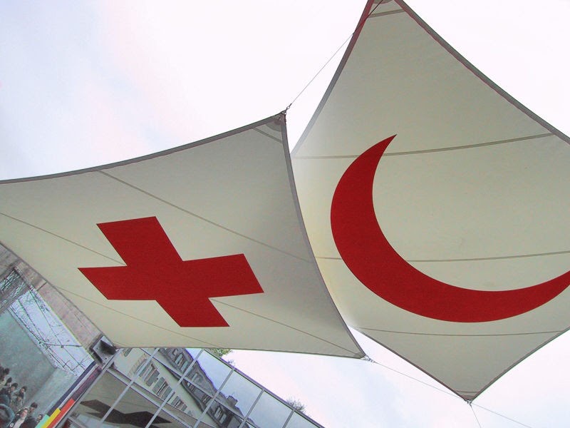
The Red Cross and OXFAM are a examples of  a non-governmental organisations  (NGO's).

Friday, 24 May 2013

The effects of development on the water balance.


The effects of development on the water balance. Increased amounts of impervious cover, 
result in more rainfall being converted into surface runoff. 


Urban renewal

Urban renewal is a process in which th obsolete fabric of an urban area is restored, renovated and improved in order to meet contemporary needs. in most cases an attempt is made to retain its original character, but if this is impossible, a certain amount of redevelopment may be included. 

Redevelopment involves the total destruction of all or part of the obsolete fabric before the work of new building, open spaces, possible new roads etc. begins.

Examples of urban renewal around the world:

  • London Docklands in London (England, United Kingdom).


  • Eastern Harbour District in Amsterdam (Netherlands).
  • Wilhelminapier in Rotterdam (Netherlands).


Wednesday, 15 May 2013

Subsidence

Subsidence is the motion of the Earth's surface as it shifts downward.
Land subsidence occurs when large amounts of groundwater have been excessively withdrawn from an aquifer (an aquifer is an underground layer of water-bearing permeable rock or unconsolidated materials). The clay layers within the aquifer compact and settle, resulting in lowering the ground surface in the area from which the groundwater is being pumped.
Over time, as more water is removed from the area, the ground drops. Once the water has been removed from the sediment, it cannot be replaced.