Monday 31 October 2011

Africa - SWOT analysis


Helpful
Harmful

Internal
Strengths
·     Africa is a continent filled with possibilities for tourism 
·     Focus on environmental issues: Wildlife conservation (example: protecting Madagascar’s biodiversity)  
·     Developing financial industry and shipping industry (example: South Africa)  
·     Crude oil resources (example: Nigeria)
·     Africa ranks first in the world in the concentration of the world's largest accumulated reserves of gold, antimony, bauxite, chromium, cobalt, diamonds, fluorspar, hafnium, manganese, phosphate rock, platinum metals, titanium, vanadium, vermiculite and zirconium.
·     Growing domestic market
·     Low cost of production
·     Availability of manpower
Weaknesses
·     Poverty / employment structure
·     HIV / AIDS
·     Corruption (example: Nigeria)
·     Favouritism
·     Internal conflicts (civil war) and refugees
·     High Unemployment
·     Urbanisation
·     Access to clean water
·     Education and literacy
·     Discriminatory Problems
·     Gender inequality
·     High Unemployment Rate
·     Absence of important skills
·     Poor infrastructure hindering competitiveness
·     Desertification (example: Sahel)
·     Deforestation (example: rainforests in Congo Democratic Republic)
·     Only forty-six percent of people in Africa have safe drinking water
·     The weakness of the African states
·     The biggest risk to African wildlife today is the habitat destruction


External
Opportunities
·     Continuous pressure on multinationals to reduce cost and the multinationals move different stages of the production process to countries with lower costs
·     China and India, Asia's two emerging powerhouses, have made no secret of their desire to engage with resource-rich Africa as they seek new economic partnerships to fuel their booming economies.
·     Potentials for innovation and entrepreneurship
·     Fifa world cup (example: South Africa in 2010)

Threats
·     Protectionism
·     Cholera Outbreak
·     Interstate conflicts, refugees and terrorism
·     Competition from other low cost countries
·     Africa suffers from global warming
·     The African population is more at risk from rising food and energy prices
·     Africans are severely affected by the inequities of the current international trading system
·     Increased trade barriers


.

Tuesday 25 October 2011

The Ecological Footprint

The ecological footprint is a measure of human demand on the Earth's ecosystems. The ecological footprint is measured by looking at resources needed to provide raw materials plus land on which to build and to absorb CO2 from burning fossil fuels.


It is a standardized measure of demand for natural capital that may be contrasted with the planet's ecological capacity to regenerate.It represents the amount of biologically productive land and sea area necessary to supply the resources a human population consumes, and to assimilate associated waste. 

Using this assessment, it is possible to estimate how much of the Earth (or how many planet Earths) it would take to support humanity if everybody followed a given lifestyle.


The next drawing shows the ecological footprint. The extent of the human demand in hectares per person. It is measured by looking at resources needed to provide raw materials plus land on which to build and to absorb CO2 from burning fossil fuels.


VIDEO - UAE Ecological Footprint Animation- English


VIDEO - The Ecological Footprint explained by Mathis Wackernagel


VIDEO - National Geographics - The Ecological Footprint 1/10


.

Monday 24 October 2011

How Old Is the Earth?

VIDEO - How Old Is the Earth?

Jill Schneiderman, professor of earth science and geography, puts human existence into perspective in this lecture about "Deep Time." A Two-Minute Lecture at Vassar College.


Chronos directed by Ron Fricke

VIDEO - Chronos - directed by Ron Fricke


Chronos is a 1985 film directed by Ron Fricke, created with custom-built time-lapse cameras. At 45 minutes long, Chronos has no actors or dialog. The soundtrack consists of a single continuous piece by composer Michael Stearns. Filmed in dozens of locations on five continents, the film relates to the concept of time passing on different scales. The bulk of the film covers the history of civilization, from pre-history to Egypt to Rome to Late Antiquity to the rise of Western Europe in the Middle Ages to the Renaissance to the modern era. It centers on European themes but not exclusively. Other time scales include the passing of seasons, and the passing of night and day, and the passing shadows of the sun in an afternoon to the passing of people on the street. These themes blend together with many symbolisms.


.

Home - a documentary by Yann Arthus-Bertrand

VIDEO - Home - a documentary by Yann Arthus-Bertrand


Home is a documentary by Yann Arthus-Bertrand. The film is almost entirely composed of aerial shots of various places on Earth. It shows the diversity of life on Earth and how humanity is threatening the ecological balance of the planet.

The documentary chronicles the present day state of the Earth, its climate and how we as the dominant species have long-term repercussions on its future.
Scientists tell us that we have limited time to change the way we live, to avoid the depletion of natural resources and the catastrophic evolution of the Earth's climate.


.

Siberia feels the heat of global warming

VIDEO - Siberia feels the heet of global warming


While the melting of the Arctic ice cap may create opportunities to exploit its oil, gas and mineral deposits, the consequences for nearby Siberia could be catastrophic.


.

Sunday 23 October 2011

Illiteracy

VIDEO - Illiteracy


Illiteracy is a plague that affects 600 million Asians. It hinders development and progress. It is the root of poverty and exploitation.


.

Life expectancy - lifestyle factors

VIDEO - Life expectancy - lifestyle factors


Starting from the national average of 77 years, Professor Danny Dorling demonstrates how even where you are born can affect when you will die. Find out how lifestyle factors such as smoking and drinking can add or take years off your life.

VIDEO - Life expectancy gap between rich and poor widens

The gap between the life expectancy of the rich and poor widened despite efforts to close it.


.

The Ageing Population

VIDEO - The Ageing Population


An overview of the UK's ageing population and references to Japan.


Floods in Bangladesh

VIDEO - Flooding in Bangladesh: Causes, Impacts and Management

http://www.youtube.com/watch?v=R3ax_v1Bnjc


Annually monsoon rains flooding large part of Bangladesh, killing thousands of people and destroying farm animals and crops. Bangladesh is vulnerable to the natural disaster of flooding due to being situated on the Ganges Delta and the many tributaries flowing into the Bay of Bengal. The coastal flooding twinned with the bursting of Bangladesh's river banks is common and severely affects the landscape and Bangladeshi society. 75% of Bangladesh is less than 10m above sea level and 80% is flood plain, therefore rendering Bangladesh a nation very much at risk of further widespread damage despite its development. Whilst more permanent defences are being built, many embankments are composed purely of soil and turf and made by local farmers. Flooding normally occurs during the monsoon season from June to September during the monsoon. The convectional rainfall of the monsoon is added to by relief rainfall caused by the Himalayas. Melt-water from the Himalayas is also a significant input and flood every year.


.

Friday 21 October 2011

Natural zones on earth

Geography describes different natural zones on earth:

Tropical rainforest

A tropical rainforest is a place roughly within 23.5 degrees north or south of the equator. They are found in Asia, Australia, Africa, South America, Central America, Mexico and on many of the Pacific Islands. The rainforests are home to more worldwide species than all other biomes added together. About 80 percent of the world's known biodiversity could be found in forests.

Desert

A desert is a landscape or region that receives an extremely low amount of precipitation, less than enough to support growth of most plants. Most deserts have an average annual precipitation of less than 250 millimetres. A common definition distinguishes between true deserts, which receive less than 250 millimetres of average annual precipitation, and steppes, which receive between 250 millimetres and 500 millimetres. Deserts can also be described as areas where more water is lost by evapotranspiration than falls as precipitation.

Steppe
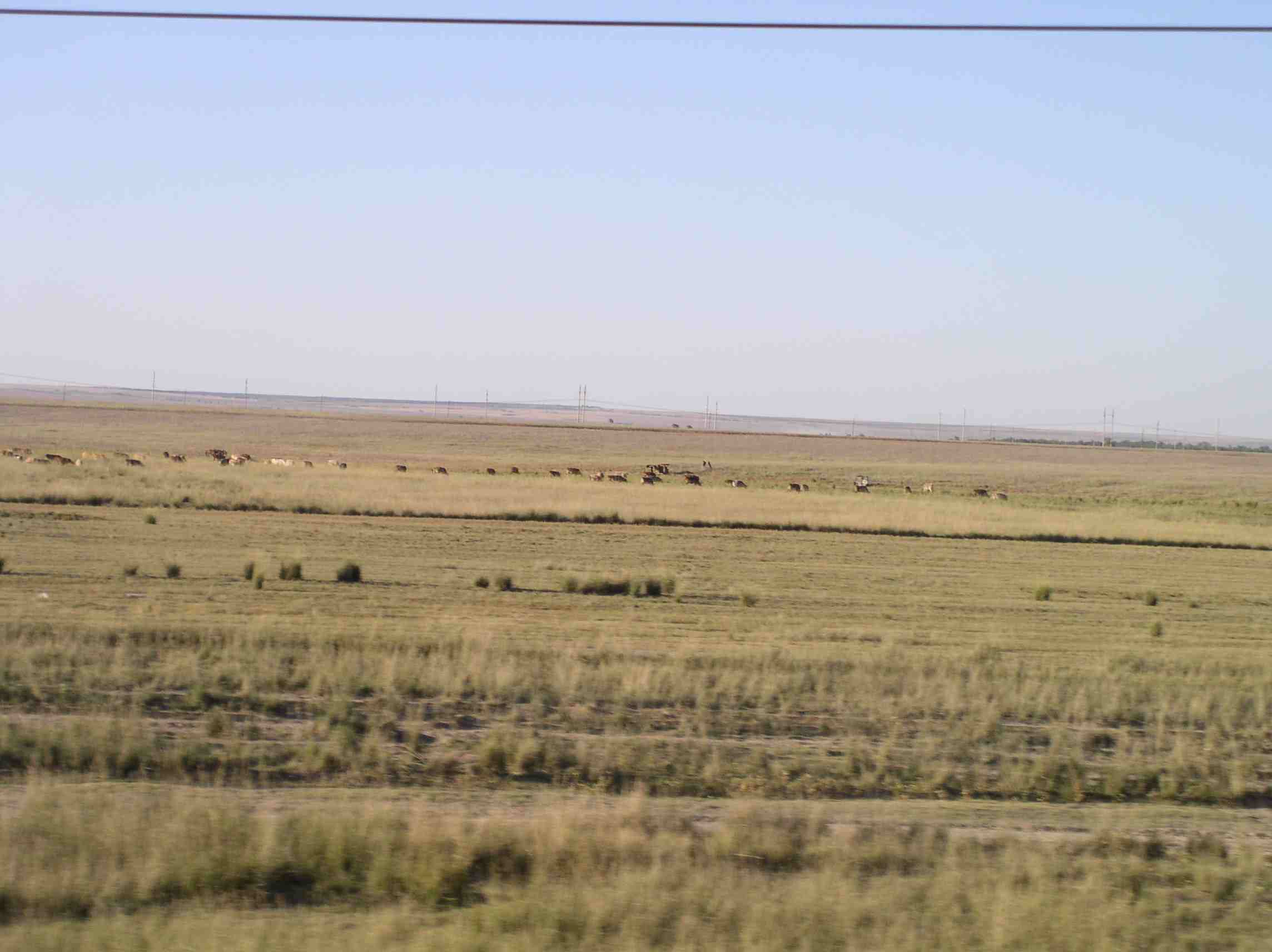
A steppes is a landscape or region that receives an low amount of precipitation, sometimes not enough to support larger vegetation. Most steppes have an average annual precipitation between 250 millimetres and 500 millimetres.

Savanna
A savanna is a grassland ecosystem characterized by the trees being sufficiently small or widely spaced so that the canopy does not close. The open canopy allows sufficient light to reach the ground to support an layer consisting primarily of grasses.


Deciduous woodland
Deciduous trees are trees that drop their leaves in the autumn. This huge leaf fall helps to create fertile material on the forest floor. The trees of the woodland are species such as oak, ash, birch and maple. They are typically about 20 to 30 metres high and form the top layer of the forest canopy. Below them on the forest floor, smaller trees and shrubs, such as holly, grow up. This very much depends on how much light is allowed through to the forest floor. Below this shrub layer a third, ground, layer is found. This consists of plants such as brambles and bracken that take up the bottom metre of the forest layers.


Coniferous woodland

Coniferous trees are evergreen, meaning that they have leaves all year round.
All the trees of a coniferous woodland, such as pines, are very similar in shape. They are conical shaped, which allows snow to easily slide off them. The leaves are actually needles, which are the most efficient leaf for these trees. The needles allow very little water loss by transpiration, which is particularly important in the relatively dry winter months.
The trees of coniferous woodland are often of only one species, and pack quite tightly together; meaning little light reaches the forest floor. Consequently there is little vegetation below the trees.


Tundra


In physical geography, tundra is a biome where the tree growth is hindered by low temperatures and short growing seasons. In tundra, the vegetation is composed of dwarf shrubs, sedges and grasses, mosses, and lichens. 


Polar ice cap and drift ice

A polar ice cap is a high latitude region of the earth that is covered in ice. Polar ice caps form because high latitude regions receive less energy in the form of solar radiation from the sun than equatorial regions, resulting in lower surface temperatures.


Thursday 20 October 2011

Basics of Geography: Climate

http://www.youtube.com/watch?v=95TtXYjOEv4&feature=results_video&playnext=1&list=PL08EA6BBD906C7474


Climate is commonly defined as the weather averaged over a long period. The standard averaging period is 30 years.

Climate includes temperature, humidity, atmospheric pressure, wind and rainfall.
Climate can be contrasted to weather, which is the present condition of these elements and their variations over shorter periods.
The climate of a location is affected by its latitude, terrain, and altitude, as well as nearby water bodies and their currents.


.

Wednesday 19 October 2011

Street children in the Philippines

http://www.youtube.com/watch?v=LFc4qQAwEsg


A street child is a child who lives on the streets of a city, deprived of family care and protection. Most children on the streets are between the ages of about 5 and 17 years old, and their population between different cities is varied.
Street children live in junk boxes, parks or on the street itself. A great deal has been written defining street children, but the primary difficulty is that there are no precise categories, but rather a continuum, ranging from children who spend some time in the streets and sleep in a house with ill-prepared adults, to those who live entirely in the streets and have no adult supervision or care.
For more than 15 years Dr. Chuck Frost, MTSU professor of Social Work, has regularly visited the Philippines. Throughout that time he has painfully noticed street children who are in desperate need. As he delved into the problem he found out that millions of children are living on the streets throughout the world.


.

São Paulo - Megacity - garbage

http://www.youtube.com/watch?v=DUl6uy6eIDc


More than 10 million people live in São Paulo and every day, they generate 14,000 tons of garbage. But São Paulo is undergoing a green revolution. Follow one aluminum can from the time it id picked up by one of the catadores (trash-pickers, who make their living from collecting recyclables) through pressing, melting, and e-melting, to the moment it is ready to become a new can.


.

City of Bath

VIDEO - City of Bath, England - THE FILM


The City of Bath was inscribed as a World Heritage Site in 1987. The city has a variety of theatres, museums, and other cultural and sporting locations, which have helped to make it a major centre for tourism. The city has two universities and several schools and colleges. There is a large service sector, and growing information and communication technologies and creative industries, providing employment for the population of Bath and the surrounding area.

.

The Richter scale - The magnitude of earthquakes


The Richter scale is the best known scale for measuring the magnitude of earthquakes. The magnitude of an earthquake is determined from the logarithm recorded by seismographs. The scale ranges from 0 to 10. Each one-point increase on the scale indicates ten times the amount of shaking and 33 times the amount of energy. For instance an earthquake at Richter scale 6 has a magnitude ten times that at scale 5. Study Fig 4 that shows the magnitude, effects and frequency of earthquakes.


Richter Magnitude
Earthquake Effects
Less than 2.0
Very small earthquakes which are not felt.
2.0 - 2.9
Detected only by seismometers.
3.0 - 3.9
About 49,000 per year
4.0 - 4.9
Everyone notice them e.g. shaking of indoor items, no significant damage.
5.0 - 5.9
Slight damage to well-designed buildings but can cause major damage to poorly constructed buildings.
6.0 - 6.9
Much damage to buildings.
7.0 - 7.9
Can cause serious damage, houses may collapse.
8.0 - 8.9
Cause serious damage, most buildings collapse.
9.0 - 9.9
1 per 20 years
10.0+
Never recorded


San Andreas Fault

VIDEO - San Andreas Fault


San Andreas Fault is a geological fault that spans a length of roughly 1,300 kilometres through California in the United States.
Large faults within the Earth's crust are the result of motion and active fault zones are the causal locations of most earthquakes.
Earthquakes are caused by energy release during rapid slippage along faults.
The San Andreas Fault, a right-lateral strike-slip fault, marks a transform boundary between the Pacific Plate and the North American Plate.


All land west of the fault on the Pacific Plate is moving slowly to the northwest while all land east of the fault is moving to the southwest under the influence of plate tectonics. The rate of slippage is approximately of 0.6 cm a year.


.

Tuesday 18 October 2011

Google Maps Introduction

http://www.youtube.com/watch?v=ADbeCHQLUpk

A brief introduction to Google Maps.
Go to Google Maps: http://maps.google.com , and explore your world.


.

De Bosatlas van de geschiedenis van Nederland

http://www.youtube.com/watch?v=LOOeBvZMep0

Kroonprins Willem-Aexander was op 11 oktober 2011 op bezoek bij Noordhoff Uitgevers in Groningen.
Uitgeverij Noordhoff bestaat 175 jaar en is vooral bekend vanwege de uitgave van Bosatlassen. De nieuwste is zojuist verschenen en heet 'Bosatlas van de Geschiedenis van Nederland'. Aan de hand van kaarten wordt de geschiedenis van ons land verteld. Willem-Alexander heeft het eerste exemplaar in ontvangst genomen.


.

De nieuwe Wereld Bosatlas ziet het levenslicht

http://www.youtube.com/watch?v=FZOXqarv470


Het ontstaan van de grootste Wereld Bosatlas tot nu toe is een feit. Het betreft een zwaarlijvig werk van meer dan 5 kilo.

De eerste Bosatlas verscheen in 1877. En ondanks het internet is de atlas nog altijd een populair naslagwerk. Uitgeverij Noordhoff Atlasproducties in Groningen denkt dat mensen toch nog vaak de overzichtelijkheid van de Bosatlas verkiezen boven de jungle die internet kan zijn.

In de nieuwe atlas zitten onder meer thematische kaarten, overzichtskaarten en satellietbeelden.
De atlas bevat ruim 600 pagina's


.

Monday 17 October 2011

Education is a right

http://www.youtube.com/watch?v=tEF0pmOS97I


Claudia Schiffer, UNICEF Goodwill Ambassador - If every boy and girl had a quality education, we could change the world. We could help put an end to poverty, disease and deprivation. Work with us to ensure that every child gets an education.
It's their right.


.

Drought in East Africa

http://www.youtube.com/watch?v=YeND1ccclto


Drought devastated much of East Africa in 2008 - 2009. In Kenya, the Kitengela Massai pastoral lands south of Nairobi, experienced many of the worst effects, including reports of the deaths of up to half of the livestock in the region. This video gives shows to Kitengela farmers with personal experience of the drought.


.

Arable and pastoral farming


Farming has two branches: arable and pastoral.

Arable is where farmers plough the land, sow seeds and grow plants to harvest.
In geography, arable land is an agricultural term, meaning land that can be used for growing crops.

Examples:
- corn,
- wheat,
- vegetables and
- soy beans.

Pastoral farming is the rearing of animals. Pastoral farming involves livestock (animals). Livestock generally are raised for subsistence or for profit. Raising animals (animal husbandry) is an important component of modern agriculture.

Examples:
- cattle (for meat, cheese and milk),
- hens or chickens (for meat and eggs) and
-sheep (for meat and wool).

Types of aid

More Economically Developed Countries (MEDCs) have high levels of economic development compared with Less Economically Developed Countries (LEDCs). Many MEDCs make allowance in their domestic budgets to provide aid to LEDCs. Many charities also exist to provide aid to LEDCs.

Types of aid

1- Emergency or short-term aid - needed after sudden disasters such as the 2000 Mozambique floods or the 2004 Asian tsunami.


2 - Conditional or tied aid - when one country donates money or resources to another (bilateral aid) but with conditions attached. These conditions will often be in the MEDC's favour, eg the controversial Pergau Dam project in Malaysia, where Britain used aid to secure trade deals with Malaysia.


3 - Charitable aid - funded by donations from the public through organisations such as OXFAM.


4 - Long-term or development aid - involves providing local communities with education and skills for sustainable development, usually through organisations such as Practical Action.

5 - Multilateral aid - given through international organisations such as the World Bank rather than by one specific country.


.

Advantages and disadvantages of aid


Sometimes, aid can bring long-term problems as well as advantages to the recipient country. The text below gives some of the arguments for and against the provision of aid to LEDCs.

Arguments for and against giving aid

For
-Emergency aid in times of disaster saves lives.
-Aid helps rebuild livelihoods and housing after a disaster.
-Provision of medical training,medicines and equipment can improve health and standards of living.
-Aid for agriculture can help increase food production and so improve the quality and quantity of food available.
-Encouraging aid industrial development can create jobs and improve transport infrastructure.
-Aid can support countries in developing their natural resources and power supplies.
-Projects that develop clean water and sanitation can lead to improved health and living standards.


Against
-Aid can increase the dependency of LEDCs on donor countries. Sometimes aid is not a gift, but a loan, and poor countries may struggle to repay.
-Aid may not reach the people who need it most. Corruption may lead to local politicians using aid for their own means or for political gain.
-Aid can be used to put political or economic pressure on the receiving country. The country may end up owing a donor country or organisation a favour.
-Sometimes projects do not benefit smaller farmers and projects are often large scale.
-Infrastructure projects may end up benefiting employers more than employees.
-It may be a condition of the investment that the projects are run by foreign companies or that a proportion of the resources or profits will be sent abroad.
-Some development projects may lead to food and water costing more.


The demographic transition model


http://www.youtube.com/watch?v=0dK3mL35nkk

http://www.youtube.com/watch?v=7vHVhn_uwTo&feature=related

The demographic transition model shows population change over time. It studies how birth rate and death rate affect the total population of a country.
The five stages of the demographic transition model
1 - Total population is low but it is balanced due to high birth rates and high death rates.
2 - Total population rises as death rates fall due to improvements in health care and sanitation. Birth rates remain high.
3 - Total population is still rising rapidly. The gap between birth and death rates narrows due to the availability of contraception and fewer children being needed to work - due to the mechanisation of farming. The natural increase is high.
4 - Total population is high, but it is balanced by a low birth rate and a low death rate. Birth control is widely available and there is a desire for smaller families.
5 - Total population is high but going into decline due to an ageing population. There is a continued desire for smaller families, with people opting to have children later in life.

As a country passes through the demographic transition model, the total population rises. Most LEDCs are at stage 2 or 3 (with a growing population and a high natural increase). Most MEDCs are now at stage 4 of the model and some such as Germany have entered stage 5.


.

Population explosion causes poverty crisis

http://www.youtube.com/watch?v=LFgb1BdPBZo


Channel 4 reports from Lagos in Nigeria on how the city's spiralling population has increased the numbers living in slums.

Formerly the capital of Nigeria, Lagos's uncontrolled population growth has made one of the world's largest cities one of the world's largest slums.


.

Slums in Kenya - going to the toilet

VIDEO - Slums in Kenya - going to the toilet


Most slums have no legal status: they are ‘illegal settlements.’ That is why local authorities do not feel responsible for providing essential facilities, such as access to clean water and sanitation.

The filthiness of the slum is intense and overwhelming. Diseases as cholera and tuberculosis are widespread in the area.

Where can you go to the toilet? This is a daily problem for the inhabitants of the slum Kibera in Kenya. Kibera is the largest slum in Nairobi, and the second largest urban slum in Africa. There are paid toilets all over the suburb. The waste water flows through an open sewer through the neighbourhood. Women are afraid to visit the toilet at night, it is too dangerous.
Most slum dwellers in Nairobi have no access to clean water.


.

Geography of Europe

http://www.youtube.com/watch?v=Z8brpoU_HNI


Europe usually refers to Europe, a peninsula in the west of Eurasia.
Europe is one of the world's seven continents.
Europe is generally divided from Asia to its east by the watershed divides of the Ural and Caucasus Mountains, the Ural River, the Caspian and Black Seas, and the waterways connecting the Black and Aegean Seas. Europe is bordered by the Arctic Ocean and other bodies of water to the north, the Atlantic Ocean to the west, the Mediterranean Sea to the south, and the Black Sea and connected waterways to the southeast.


.

Sunday 16 October 2011

Latitude, longitude and the prime meridian


The moving picture demonstrates latitude, longitude and the prime meridian.


.

Friday 14 October 2011

'Informal' work in Mexico


Many turn to 'informal' work in Mexico.
Much of Mexico's economy is in what is called the "informal" sector and it is growing. The country's unemployment rate now stands at 5.8 per cent. The government says there are now 13.5 million people working informally. Mexico's economy is set to grow this year, by just under four per cent.


President Felipe Calderon, who has promised to boost economic growth, says companies need to invest more in Mexican workers.


Thursday 13 October 2011

Tsunami in Japan 11 march 2011


http://www.youtube.com/watch?v=Ydnv2xo9Ndw&feature=results_main&playnext=1&list=PLBAB112C12E4EE3E5

File:2011 Tohoku earthquake observed tsunami heights en.png
The 2011 earthquake off the Pacific coast of Tohoku, also known as the 2011 Tōhoku earthquake had a magnitude 9.0 with the epicenter approximately 70 kilometres east of the Oshika Peninsula of Tōhoku and the hypocenter at an underwater depth of approximately 32 km. It was the most powerful known earthquake ever to have hit Japan, and one of the five most powerful earthquakes in the world overall since modern record-keeping began in 1900.

.

How do tsunamis relate to Earthquakes

Tsunami is a set of ocean waves caused by any large, abrupt disturbance of the sea-surface. If the disturbance is close to the coastline, local tsunamis can demolish coastal communities within minutes.

A tsunami, also called a tsunami wave train, and at one time referred to as a tidal wave, is a series of water waves caused by the displacement of a large volume of a body of water, usually an ocean, though it can occur in large lakes. Owing to the immense volumes of water and the high energy involved, tsunamis can destroy coastal regions.
Earthquakes, volcanic eruptions and other underwater explosions, landslides, underwater landslides and meteorite ocean impacts or similar impact events have the potential to generate a tsunami.


.