Tuesday 10 December 2013

Spatial interaction

Spatial interaction is the flow of products, people, services, or information among places, in response to localized supply and demand.

Spatial interactions usually include a variety of movements such as:

  • travel, 
  • migration, 
  • transmission of information, 
  • journeys to work or shopping, 
  • retailing activities, or 
  • freight distribution.


The basis of spatial interaction is based on three phenomena

  • complementarity (a deficit of a good or product in one place and a surplus in another), 
  • transferability (possibility of transport of the good or product at a cost that the market will bear), and 
  • lack of intervening opportunities (where a similar good or product that is not available at a closer distance).

Tuesday 3 December 2013

Tourism and tourists

Tourism is travel for: 
recreational, 
leisure, or 
business purposes.

The World Tourism Organization defines tourists as people "traveling to and staying in places outside their usual environment for not more than one year for leisure, business and other purposes". Additional words for tourists are holidaymaker, traveler, sightseer, visitor, excursionist, backpacker, globetrotter, day tripper, tripper


Places that a lot of people visit are called "resorts".


There are a lot of reasons why people travel for fun:


  • Some people travel to learn about the history of a city or country.
  • People from cold places might want to relax in the sun. Many people from the north of Europe travel to Spain, Italy, Greece and Turkey for the sun.
  • Some people travel to do an activity which they cannot do at home. There are lots of skiing resorts in Switzerland and Austria, where people who do not have mountains at home can ski.
  • People sometimes visit friends and family in another city or country.
  • Some people enjoy a change in scenery.

Tourism in the Netherlands 
The Netherlands is well-known for its 
  • culture, art and rich historical heritage,
  • major cities,
  • water and beaches and
  • forest and natural areas.
The Netherlands was visited by 11.3 million foreign tourists (in 2011).
The Dutch tourism industry contributed 5.4% in total to the country's GDP and 9.6% in total to its employment (in 2012). 
Tourism is a relatively small sector of the Dutch economy. Germans (3 million tourists per year), Britons (1.5 million tourists per year) and Belgians (1.4 million tourists per year) made up the majority of foreign tourists.


Tuesday 22 October 2013

Port of Shanghai

The world's busiest port is contested by several ports around the world, as there is as yet no standardised means of evaluating port performance and traffic. 

For the past decade, the distinction has been claimed by both the Port of Rotterdam and the Port of Singapore. The former based its measurement on cargo tonnage handled (total weight of goods loaded and discharged), while the latter ranked in terms of shipping tonnage handled (total volume of ships handled). 

Since 2005, the Port of Shanghai has exceeded both ports to take the title in terms of total cargo tonnage.


The Port of Shanghai, comprises a deep-sea port and a river port.


Tuesday 10 September 2013

Assimilation and integration

What is the difference between assimilation and integration?

Assimilation means that migrants must adapt as much as possible and adopt the national culture. Requiring them to adopt the majority's language, customs and 'values'. 
Assimilation means absorbing minorities into the ways of the majority. 


Integration mens that migrants take an active part in society.
Integration, by contrast, requires acceptance of a country's laws, of human rights such as freedom of speech, and of basic democratic rights, but does not require the eradication of all cultural differences or group-identities; it is conceived of as a two-way process, through which both the majority and the minorities influence and change one another, and in which differences can be peacefully accommodated as long is there a common commitment to living together.


The word segregation means separation. Segregation is separation of humans into (ethnic) groups in daily life.

Monday 9 September 2013

Dependency ratio

Dependency ratio is the ratio between those of working age and those of non-working age. 
The dependency ratio tells us how many young people (age group 0 to 19) and older people (age group 66 and older) depend on people of working age (age group 20 to 65). 


The dependency ratio is worked out with this formula:


number of 0 to 19 years-olds + number of people aged 65+
--------------------------------------------------------------------------------- x 100%
                    number of 20 to 65 years-olds


Example: Pakistan
A worked example should make this clearer. Pakistan, which is a developing country, has 41% of its population less than 20, and 4% over 65. This makes 55% (100 - (41+4)) between the ages of 15 and 64.


Dependency ratio of Pakistan

     (41) + (4)
= ---------------- x 100
           55

    45
= ----- x 100
    55


=  81.8


Example: New Zealand
New Zealand, a developed country, has 23% of its population less than 20, and 12% over 65. This makes 65% between 15 and 64.


Dependency ratio of New Zealand

     (23) + (12)
= ---------------- x 100
           65

    35
= ----- x 100
    65


=  53.8


Countries that have a high dependency ratio have more people who are not of working age, and fewer who are working and paying taxes. The higher the number, the more people that need looking after.

Friday 30 August 2013

Colonisation of the US

European colonisation of the Americas began as early as the 10th century (Vikings, Norse sailors) 

Extensive European colonisation began in 1492, when a Spanish expedition headed by Christopher Columbus sailed west to find a new trade route to the Far East but inadvertently found the Americas. European conquest, large-scale exploration, and colonization soon followed. 

The next map shows the European claims in America in 1750.


When the United States won its independence from Great Britain at the end of the Revolutionary War, the country nearly doubled in size. 


After 1783, the United States gained new land from European countries, neighboring countries (such as Mexico), and Indian tribes. This was done through purchases (paying for it), wars and treaties, and the forced removal of Indian tribes from the lands they had occupied for thousands of years.


The 13 original British colonies became the country's first states, but they were not the same size and shape as they are today. It took more than 176 years — from 1783 to 1959 — for all 50 states to become part of the United States of America.


Tuesday 13 August 2013

Exogenetic process

The exogenetic processes are the processes that shape the land by forces coming on or above the Earth's surface (exogenetic forces).

For example: 
  • The Moon causes tides in the Earth's oceans and other big bodies of water (as a result of other bodies in space). 
  • Impacts from comets and meteoroids change the surface of the Earth. When they strike the Earth, they create craters which are holes, which can be very big or small, in the ground (as a result of other bodies in space).
  • Radiation from the Sun can cause aurorae, which are lights that can be seen at night near the poles (as a result of other bodies in space).
  • An example of an exogenetic process that is not as a result of bodies in space is erosion. Erosion happens as a result of wind, water, ice, or people, animals, or plants digging in the earth.

Endogenetic process

The endogenetic processes are the processes that shape the land by forces coming from within the earth (endogenetic forces). Endogenetic process is also called endogenic process. 

There are 3 main endogenetic processes: 

  • folding, 

  • faulting and 

  • volcanism. 

They take place mainly along the plate boundaries, which are the zones that lay on the edges of plates. These zones are weak. Endogenetic processes cause many major landform features.

Monday 12 August 2013

The Grand Canyon

The Grand Canyon is a famous, steep-sided canyon carved by the Colorado River in the United States in the state of Arizona. The Grand Canyon is considered one of the Seven Natural Wonders of the World. The Grand Canyon became a national monument in 1908, but wasn't designated as a national park until 1919.


The Grand Canyon is 446 km long, up to 29 km wide and attains a depth of over 1,800 meters.
Nearly two billion years of the Earth's geological history have been exposed as the Colorado River and its tributaries cut their channels through layer after layer of rock while the Colorado Plateau was uplifted by tectonic action.


Evidence suggests the Colorado River established its course through the canyon at least 17 million years ago. Since that time, the Colorado River continued to erode and form the canyon to the point we see it at today.


Many people come from around the world to visit the Grand Canyon. People can also take trips floating on the Colorado River in boats and rafts. Some people like to hike in the Grand Canyon.


Sunday 7 July 2013

Z - list of geographical terms and definitions

Z
Zenith: The highest point in heaven directly above our heads.
Zeugen: Zeugen, also known as mushroom rocks or rock pedestals, are one of the most striking manifestation of the processes of erosion and weathering. They are mostly found in deserts.
Zonal soil: Zonal soil refers to any one of the great groups of soil which have well-developed soil characteristics and reflect the zonal influence of climate and living organisms, mainly vegetation, as active factors of soil genesis.
Zone in Transition: the inner city area around the CBD. It is a zone of mixed land uses, ranging from car parks and derelict buildings to slums, cafes and older houses, often converted to offices or industrial use.
Zoning: where industry is separated from residential areas to avoid pollution, traffic congestion etc. Zoned areas are a result of planning.
Zooplankton: In geographic terms, a zooplankton refers to the aggregate of animals or animal-like organisms in plankton, as protozoans.


Y - list of geographical terms and definitions

Y
Yardang: In geography, yardang refers to a keel-shaped crest or ridge of rock. It is formed by the action of wind, usually parallel to the prevailing wind direction.
Yield: how many crops a particular field, farm, or area of land produces. It also applies to milk (yields) from dairy cows.
Yield: The term yield has a lot of interpretations in several contexts. However, in geography, the term yield refers to give forth or produce by a natural process or in return for cultivation.
Younger Dryas: In geography, dryas refers to any creeping plant belonging to the genus Dryas, of the rose family, having solitary white or yellow flowers, comprising the mountain avens. Hence a younger dryas refers to a dryas that is younger.
Youthful Population Structure: seen as a wide base on population pyramids that reflect high birth rates in LEDCs.
Youthful Population: in the population structure of LEDCs, there is often a higher proportion of young people due to high birth rates and a reduction in infant mortality due to better nutrition, education and medical care. This may create problems since the children need feeding, housing, education and eventually a job. Medical care and education has to be paid for by taxing a proportionally small number of workers.


X - list of geographical terms and definitions

X
Xerophytic: In geography, xerophytic refers to one which has adapted itself to a xeric (which means dry) environment.
Xerosere: Xerosere refers to describe a sere occurring in dry soil.


W - list of geographical terms and definitions

W
Wadi: A wadi is the Arabic term for a valley or stream bed in northern Africa and the Middle East. It remains dry all year round, except during the rainy season.
Walker Cell: The Walker circulation is also known as the Walker cell. It is a conceptual model of the air flow in the tropics in the troposphere. Parcels of air follow a closed circulation in zonal and vertical directions, according to this theory.
Warm front The forward edge of an advancing warm air mass that is rising over cooler air in its path.
Warm front: Warm front is referred to the front of a mass of warm air.
Warm sector The zone of warm air within a depression.
Water balance: Water balance refers to the ratio between the water assimilated in the body and water lost from the body.
Water Management: Water management is the activity that consists of planning, development, distribution and optimum use of water resources under defined water polices and regulations.
Water Table: In geography, the term water table means a planar underground surface beneath which, earth materials such as soil or rock are saturated with water. At this level, the ground water pressure is equal to the atmospheric pressure.
Water table: The level below the land surface at which the subsurface material is fully saturated with water. The depth of the water table reflects the minimum level to which wells must be drilled for water extraction.
Water vapour Water substance in vapour (gaseous) form; one of the most important of all constituents of the atmosphere.
Waterfalls: form where the river meets a band of softer rock after flowing over an area of more resistant material. Waterfalls progressively cut back, leaving a gorge.
Waterlogged: Waterlogged is a phenomenon where an object is so filled or flooded with water that it seems to be heavy or unmanageable.
Watershed: The term watershed refers to the ridge or crest line dividing two drainage areas.
Watershed: the highland separating one river basin from another.
Wave Attack Zone: the area between low and high tide where wave erosion is most effective.
Wave Cut Platform: a gently sloping, rocky platform found at the foot of an eroding cliff and exposed at low tide.
Wave Erosion: the power of the wave is generated by the fetch. Waves erode cliffs by abrasion/corrasion and hydraulic pressure.
Wave Pounding: Wave pounding is the 'sledge hammer' effect that is caused by tons of water crashing against cliffs. It is responsible for shaking and weakening the rocks, leaving them open to attack from hydraulic action and abrasion. Eroded material, mostly, gets carried away by the waves.
Wave: The term wave can be explained as a disturbance on the surface of a liquid body, such as a sea or a lake. This disturbance is ordinarily in the form of a moving ridge or swell.
Wave-cut Notch: A wave-cut notch or platform or shore platform is the narrow flat area that is often seen at the base of a sea cliff. It can also be seen along a large lake shore caused by the action of waves.
Wave-Cut Platform: A wave cut platform is the same as a wave cut notch.
Waves: caused by the transfer of energy from the wind blowing over the surface of the sea. The largest waves are formed when winds are very strong, blow for lengthy periods and cross large expanses of water. See Fetch and Prevailing Wind.
Weather The state of the atmosphere, mainly with respect to its effects upon life and human activities. As distinguished from climate, weather consists of the short-term (minutes to about 15 days) variations of the atmosphere state.
Weather: In simple words, weather refers to the state of the atmosphere with respect to wind, temperature, cloudiness, moisture, pressure, etc.
Weather: The condition of the atmosphere at a certain place and at a certain time.
Weathering the break-down or decomposition of rock by biological, physical or chemical processes.
Weathering: In geographical terms, weathering refers to the various mechanical and chemical processes that cause exposed rock to decompose.
Weathering: the break-down of rock by physical or chemical processes.
Well: As opposed to literature, in geography, the term well refers to a hole drilled or bored into the earth to obtain water, petroleum, natural gas, brine and sulfur.
Wet Lands: land only suitable for grazing of animals, but very valuable for wildlife, especially birds. These are under pressure from farmers who want to drain the land to make it suitable for more profitable arable farming.
Wet Point Site: a settlement location where the main advantage is a water supply in an otherwise dry area e.g. at a spring where an impermeable clay valley meets the foot of permeable limestone or chalk hills.
Wetland: A wetland is a lowland area, such as a marsh or a swamp, that is saturated with moisture. It is mostly regarded as the natural habitat of wildlife.
Wetted Perimeter: In geography, a wetted perimeter is the perimeter of the cross sectional of the area that is "wet."
Wholesaling: the sale of goods to retailers; wholesalers are not open to the general public.
Wilderness: Wilderness refers to a wild and uncultivated region, such as a forest or a desert. It is uninhabited or inhabited only by wild animals. It could also mean a tract of wasteland.
Wildlife Habitats: The homes of plant and animals.
Wilting Point: Much like boiling point and evaporation point, wilting point (WP) is defined as the minimal point of soil moisture required by the plant to avoid its wilting. In case the moisture decreases to this point or any lower, a plant wilts and can no longer recover its turgidity when placed in a saturated atmosphere for 12 hours.
Wind Erosion: In geography, wind erosion refers to erosion of material caused by the action and chemical reaction of wind.
Wind power: Wind power refers to the conversion of wind energy into a useful form of energy, such as electricity, using wind turbines.
Wind movement of air caused by changes in temperature and air pressure. Winds are always identified by the compass direction from which they blow.
Wind: Wind, in geography, refers to air moving from an area of high pressure to an area of low pressure.
Windward: In simple words, the term windward refers to 'towards the wind'. More so it directs toward the point from which the wind blows.
Windward: The side of a land mass facing the direction from which the wind is blowing—the opposite of leeward.
Wine Lake: surplus wine in the EU as a result of over-production.
Work: employment at a job or occupation; either formal or informal.
Working Population: people in employment who have to support the dependent population.


V - list of geographical terms and definitions

V
Valley Glacier: A valley glacier is a glacier that is enclosed by the walls of a mountain valley and flows down these walls.
Valley Glacier: see Glacier.
Valley: An area of lowland with slopes either side. A river flows along the lowest part.
Varve: A varve is a sediment bed, made up of a series of sediment layers, that is annually deposited in a still water body near a glacial area.
Vector: In geographical terms, vector is defined as a force that has both direction and magnitude.
Vegetation: All kinds of plants including shrubs and trees.
Vegetation: a ground cover of bushes and grass on a cliff face helps prevent cliff erosion; their roots hold and trap (stabilise) soil and prevent it being lost by mass movement.
Velocity: the speed of the water flow.
Vent: A vent is a pipe like opening in the earth's crust, that directs the flow of volcanic material. A volcano may have one or more than one vent.
Vent: The opening at the Earth's surface through which volcanic materials (lava, tephra, and gases) erupt. Vents can be at a volcano's summit or on its slopes; they can be circular (craters) or linear (fissures).
Vineyard: Where grapes are grown to make wine.
Viscosity: Measure of the fluidity of a substance. Taffy and molasses are very viscous; water has low viscosity.
Visibility: Visibility is the maximum distance up to which a person can see under a particular weather condition, without the assistance of any instrument.
Volcanic avalanche: A large, chaotic mass of soil, rock, and volcanic debris moving swiftly down the slopes of a volcano. Volcanic avalanches can also occur without an eruption due to an earthquake; heavy rainfall; or unstable soil, rock, and volcanic debris.
Volcanic Cone: A volcanic cone is a conical hill formed during a volcanic eruption made up of lava, tufa and cinders.
Volcanic Plume: Volcanic plume is a mixture of gas, lava and other particles that is emitted during a volcanic eruption, generated when the magma is fragmented.
Volcano: A cone-shaped mountain made up from lava and ash.
Volcano: A vent (opening) in the Earth's surface through which magma erupts; also the landform that is constructed by eruptive material.
Volcano: A volcano is a land form, often a mountain, through which magma, gases and ashes erupt and flow out.
Voluntary Migration: where people move to another area through choice.
V-shaped Valley: A v-shaped valley is a valley that has a cross-sectional profile and that is formed by the eroding action of streams.
V-shaped Valley: a deep v-shaped valley is usually found in the upper course of the river where the water has considerable erosive power.
Vulcanism: Vulcanism, also known as volcanism, is a term used to describe the study of any kind of volcanic activity.


U - list of geographical terms and definitions

U
Ubac: The northern side of an Alpine mountain that is shady and characterized by a low snow line and timberline is known as Ubac.
Under-Class: the new urban poor who are often ill, unemployed, homeless, unqualified, and with health problems.
Underemployment: A condition among a labor force such that a portion of the labor force could be eliminated without reducing the total output. Some individuals are working less than they are able or want to, or they are engaged in tasks that are not entirely productive.
Underemployment: the situation where people do not have fulltime, continuous work, and are usually only employed temporarily or seasonally (e.g. during the summer months in a hotel).
Underpopulation: Economically, a situation in which an increase in the size of the labor force will result in an increase in per worker productivity.
Unemployment (= werkloosheid).
Unemployment occurs when people are without work and actively seeking work.
Unemployment Rate: The number of people out of work for each 1000 of the population.
Unskilled manual occupations: these jobs require no specific skills.
Updrift: areas that provide a supply of material for deposition by longshore drift further along the coast. Updrift areas along the south coast of England are to the west.
Upper Course: the mountain stage of a river with steep gradients and much erosion.
Urban Climate:The climatic condition of a large metropolitan area, that is considerably different from the climate in the rural areas surrounding it, is called urban climate.
Urban Diseconomies: the rising costs to industry as cities increase in size, due to increasing cost of land and labour, traffic congestion, crime etc.
Urban Fringe: see rural-urban fringe.
Urban Hierarchy: see hierarchy.
Urban Population Structure: young males move to urban areas due to push-pull factors. This creates a characteristic population pyramid bulge in the 20-35 age range.
Urban Redevelopment: the total clearance of parts of old inner city areas and starting afresh with new houses, especially high-rise flats.
Urban Renewal/Regeneration: the improvement of old houses and the addition of amenities in an attempt to bring new life to old inner city areas.
Urban Sprawl: the unplanned uncontrolled growth of urban areas into the surrounding countryside.
Urban: Large area of houses, factories, etc..
Urbanisation: the growth of towns and cities leading to an increasing proportion of a country’s population living there. It as a gradual process common in LEDCs where 1 million people move from the countryside to the cities every three days.
Urbanisation: the process by which an increasing percentage of a country's population comes to live in towns and cities. Rapid urbanisation is a feature of most LEDCs.
Urban-Rural Shift: the movement of industry away from urban areas in recent years due to urban diseconomies, improvements in communications (motorways) and telecommunications (internet/fax/computer links), counter-urbanisation (the move of the middle class workforce to small towns and villages) and planning policies (government incentives, new towns, green belts).
Urban-Rural Shift: the movement of people out of towns in MEDCs to seek a better quality of life living in the countryside. Some work from home using telecommunications technology; most travel into the city each day as commuters, contributing to the rush hour.
U-shaped Valley: A U-shaped valley is a type of glacial valley, formed due to glacial erosion and characterized by steep walls and broad floors.
U-shaped Valley: see Glaciated Valley.
Utility: In geographical terminology, utility is a term used to describe an industry that provides a service or commodity that can be used by consumers.


T - list of geographical terms and definitions

T
Taiga: A moist subarctic coniferous forest that begins where the tundra ends and is dominated by spruces and firs.
Talik: Talik is a Russian term used to describe a permanently unfrozen section of ground in a region of permafrost. There are different types of talik like through talik, closed talik and open talik.
Tariffs: tax (customs duties) charged on imported goods. e.g. manufactured goods from LEDCs to the EU face a tariff of 30%. Japanese companies have located in the EU to avoid tariffs; these do not apply if 60% of the components are made in Europe.
Tarn: a deep circular lake filling a cirque hollow.
Technology: New ways of using resources and developing new equipment.
Tectonic: Tectonic is a term used to define anything that is causing, related to, or resulting from processes that work to give the earth's crust some sort of shape.
Teleworking: using telecommunications to work from home.
Teleworking: working from home using telecommunications.
Temperate Crops: plants best suited to the climate of the cooler temperate latitudes e.g. Britain.
Temperature: Temperature is measured with a thermometer. Two different temperature scales; in Celsius (freezing point is 0 degress, boiling point is 100 degrees) and in Fahrenheit (freezing point is 32 degress, boiling point is 212 degrees).
Temperate Deciduous Forest: Temperate deciduous forests are seasonal biomes found in central, western and eastern Europe, eastern Australia, some parts of China and Japan, and eastern North America. These forests are characterized by moderate temperature and rainfall and deciduous trees like oak, maple, ash, etc. that lose their leaves annually.
Temperature inversion: An increase in temperature with height above the Earth's surface, a reversal of the normal pattern.
Temperature Inversion: Temperature inversion is a phenomenon in which the temperature increases with increasing altitude instead of decreasing with increasing altitude. This is due to factors like sea air being invaded by onshore breeze that is cooler than the sea air or because of the passage of a cold front.
Temperature range Maximum minus the minimum temperature for a particular location.
Temperature A physical quantity characterizing the mean random motion of molecules in a physical body. In other words, it is a measure of the degree of hotness or coldness of a substance.
Tenant Farmer: farmers who do not own the land they cultivate. Their rent is usually a fixed percentage of the harvest each year.
Tenant: a person who rents his/her home from a private landlord or the local council.
Tenement Blocks: Large residential blocks built in the inner cities of the MEDCs during the Industrial Revolution to house workers in high density cramped and unhygienic conditions next to the factories.
Tenure: the way in which property is held. A house of flat may be owned by the occupier or rented, either from the council or from a private landlord.
Tephra: Solid material of all sizes explosively ejected from a volcano into the atmosphere.
Terminal Moraine: a prominent ridge of rock debris dumped at the end of a glacier and formed of unsorted boulders, sand, gravel and clay.
Terms of Trade: the relationship between the average price of exports and the average price of imports. Terms of Trade always favour MEDCs at the expense of LEDCs. See Structure of Trade.
Terraced House: a house within a (usually) long line of joined housing. Terraced housing is typical of the inner city zone in the U.K.
Terraces: fields on steep hillsides are terraced to provide flat growing areas for crops.
Terracettes: step-like features on banks and hillsides, the result of soil creep.
Terracing: the construction of horizontal steps down the cliff face; once these become vegetated, they help stabilise the cliff and prevent erosion.
Territory: A specific area or portion of the Earth's surface; not to be confused with region.
Tertiary Industry: does not produce anything but involves work in the service sector of the economy. It includes activities associated with commerce and distribution (wholesaling and retailing) as well as banking, insurance, administration, transport, tourism, health, education and entertainment services.
Tertiary sector: That portion of a region's economy devoted to service activities (e.g., retail and wholesale operations, transportation, insurance).
Thermosphere: Thermosphere is the outermost surface of the atmosphere, that lies above the mesosphere and below the exosphere. It is a region where temperature increases steadily with altitude.
Threshold Population: the minimum number of people required to support a particular good, shop or office. For example, large stores such as Marks & Spencer have a threshold population of over 100,000, whilst shoe shops have a threshold population of about 25,000.
Threshold: The minimum-sized market for an economic activity. The activity will not be successful until it can reach a population larger than this threshold size.
Tidal Energy: The energy obtained from harnessing tidal motions of water is called tidal energy. The energy harnessed is used to produce electricity.
Till: also known as Boulder Clay.
Time distance: A time measure of how far apart places are (how long does it take to travel from place A to place B?). This may be contrasted with other distance metrics such as geographic distance (how far is it?) and cost-distance (how much will it cost to get there?).
Time: an important factor in coastal erosion and deposition.
Time: an important factor in glacial erosion and deposition.
Time: an important factor in river erosion and deposition.
Tombolo: a spit joining an island to the mainland.
Topographic map: A map that uses contour lines to represent the three-dimensional features of a landscape on a two-dimensional surface.
Topographical Map: Topographical map is a type of large-scale map that represents both natural and man-made two-dimensional, surface geographical features.
Topography: The physical features of a place; or the study and depiction of physical features, including terrain relief.
Tornado: A tornado is a violent and destructive windstorm or column of air that extends downward from a cumulonimbus or funnel-shaped cloud. Its speed is about 100 to 300 miles per hour and it is known to cause a lot of destruction along its path.
Tourist Attractions: Places where people travel for interest and pleasure.
Tourist Developments: resorts such as Barton on Sea wish to build their beaches to attract tourists who are an important source of income to the area. Cliff-top hotels, however, can actually contribute to erosion,creating an impermeable zone that increases saturation in the surrounding cliff area. Tourists walking on the cliff face also contribute to erosion by destroying vegetation.
Toxic Waste: Poisonous waste material that comprises chemical compounds that can cause injury or death if inhaled or ingested is called toxic waste.
Traction: material rolled along the bed of the river.
Trade Deficit: where a country imports more goods than it exports.
Trade Surplus: where a country exports more goods than it imports.
Trade Winds: Trade winds are the steady winds that blow towards the equator, from the northeast in the northern hemisphere, and from the southeast in the southern hemisphere.
Trade: The exchange of goods or services.
Trading Blocs: groups of countries who join together for tax-free trading purposes e.g. the EU.
Traditional Industries: old heavy industries located where cheap energy (coal) and raw materials, e.g. iron ore were found.
Trampling: a process caused by overgrazing, where the soil becomes compacted (compressed) by animal hooves, making it impermeable and useless for farming.
Transferability: The extent to which a good or service can be moved from one location to another; the relative capacity for spatial interaction.
Transhumance: The seasonal movement of people and animals in search of pasture. Commonly, winters are spent in snow-free lowlands and summers in the cooler uplands.
Transition Zone: see Zone in Transition.
Trans-national Corporation (TNC): large companies which have branch plants throughout the world; their headquarters are often found in MEDCs.
Transnational Corporation: a very large company, with factories in many different countries, often making and selling a range of products.
Transpiration: The process by which moisture leaves the plants through small openings in the leaves, known as stomata, into the atmosphere, is known as transpiration. This process is regulated by the plant on the basis of its water requirement and the climate and the process also affects the growth and wilting of the plant.
Transport: Ways of moving people and goods from one place to another.
Transportation: The movement of eroded material by rivers, sea, ice and wind.
Transportation: the river moves material as bedload, suspended load or dissolved load (in solution). Bedload can be moved by saltation or traction.
Tree line: Either the latitudinal or the elevational limit of normal tree growth. Beyond this limit, closer to the poles or at higher or lower elevations, climatic conditions are too severe for such growth.
Tributary: A small river which flows into the main river.
Tributary: A tributary is a stream or river that flows into a larger river or a large body of water called the main channel.
Tributary: a smaller river that joins a larger one.
Trophic Level: Trophic level is the position in the food chain that is occupied by different organisms. The trophic level indicates the frequency of energy transfer that has taken place through feeding.
Tropical Cyclone: A tropical cyclone is a type of violent storm that develops over tropical and subtropical water bodies, between latitudes 23°30' North and 23°30' South. It is characterized by heavy, violent rainstorms and cyclonic winds and is known by different names like willy-willy, taifu, etc. in different countries.
Tropical Rainforest: Tropical rainforest is a biome situated in regions if high rainfall and high temperature, consists of tall evergreen trees that grow close to each other and are known to have the maximum number of medicinal plants. The trees have columnar trunks that are somewhat unbranched and they form a flat crown that spreads frequently. Read more on tropical rainforest biome.
Tropics: Technically, the area between the Tropic of Cancer (21-1/2 N latitude) and the Tropic of Capricorn (21-1/2 S latitude), characterized by the absence of a cold season. Often used to describe any area possessing what is considered a hot, humid climate.
Tropics: the areas of the world which are close to the equator, between the Tropic of Cancer and the Tropic of Capricorn.
Troposphere: Troposphere is the atmospheric zone that is the lowest. It is situated between the tropopause and the earth's crust and comprises vertical wind motions and water vapor. It is characterized by a decrease in temperature with increasing altitude.
True North: The direction which points to the North Pole.
Truncated Spur: a former river valley spur which has been sliced off by a valley glacier.
Tsunami: A tsunami is a huge ocean wave that occurs due to an underwater volcanic eruption or underwater earthquake. It can travel at speeds of 600 km/hr, and can soar up to heights of 30 m.
Tundra: A treeless plain characteristic of the arctic and subarctic regions.
Tundra: The vast, treeless region located in the Arctic and subarctic regions and characterized by black mucky soil and frozen subsoils is known as the tundra region. This region extends across Europe, North America and Greenland.
Tundra's: Peripheral area of Arctic Ocean.
Twilight Zone: the term applied to an inner city area as it begins to change into the Zone of Transition.
Twilight Zone: The twilight zone is the lowest level or the point up to which natural light is able to penetrate in the ocean.
Typhoon: Typhoon is a type of tropical cyclone that occurs typically in the Indian ocean and the western Pacific ocean.


S - list of geographical terms and definitions

S
Salinisation: the accumulation in the soil of salts which are poisonous for plants. This is often caused by irrigation and can make the land useless for farming.
Salinization: Salinization is the process by which salt gets increasingly accumulated in soil, which decreases the fertility of the soil.
Salt Lake: A salt lake is a type of inland lake that has a higher concentration of salts, mainly sodium chloride, as compared to other lakes.
Saltation: material bounced along the bed of the river.
Sand Dune: A sand dune is a hill or mound of sand that is formed by the action of winds along shores or in desert areas.
Sandbar: A sandbar, also known as a shoal or a sand bank, is a ridge of sand, partly exposed or submerged, formed along a shore or river. This ridge is built by the action of tides, currents or waves and consists of tiny pebbles, sand and silt.
Saturation: loose surface material after heavy rain can become saturated and therefore unstable due to the extra weight, leading to mud slides. Where permeable sand rock overlays impermeable clay (e.g. the cliffs at Barton on Sea), the sand can become saturated and slump or slide along a shear plane.
Savanna: Savanna is a term used to describe tropical grassland areas having scattered vegetation, comprising dense spaced trees and bushes. The term was originally used to describe tropical grasslands with some scattered dense tree areas.
Scale: The proportional relationship between a linear measurement on a map and the distance it represents on the Earth's surface.
Scenery: The appearance or view across the natural landscape.
Scenic: Attractive and interesting view of the landscape.
Science Parks: An area of land, often located near university sites, where high-tech industries are located. Scientific research and commercial development are carried out in co-operation with the university.
Scree: a slope of loose, large angular rocks broken away from the mountainside by freeze-thaw weathering.
Screwdriver industries: industries based on the routine assembly of products manufactured elsewhere e.g. Sony, South Wales.
Sea Breeze: A sea breeze is a cooling local wind that blows from the sea to the land, due to differences in temperature of the surface of the land and the surface of the sea.
Sea Defences: measures taken to defend the coast from erosion, cliff collapse and flooding.
Sea Level Changes: changes in the level of the sea against the land are caused by either the building up of melting of polar ice caps, or by rising and falling land levels.
Sea level: The ocean surface.
Sea Walls: aim to prevent erosion of the coast by providing a barrier which reflects wave energy.
Sea-level Change: Sea-level change is a change in the volume of water in the seas and oceans, with respect to a change in the position of the land. Sea-level change is of two types - eustatic, where there is change in the level of water due to the melting of ice and snow, and isostatic, where there is a change in the vertical position of the land caused by the melting of ice and snow in large quantities.
Seam: see Coal Seam.
Seasonal Jobs: Employment that lasts for only part of the year.
Seasonality Periodic fluctuations in the climate related to seasons of the year e.g. wet winters, drier summers.
Sea-wave: In geographical terms, waves that indicate a horizontal energy movement but a vertical movement of water are known as sea-waves.
Second home: A seasonally occupied dwelling that is not the primary residence of the owner. Such residences are usually found in areas with substantial opportunities for recreation or tourist activity.
Second Homes: homes purchased by city dwellers in country villages or areas of usually great natural beauty for holiday or weekend use only. These create problems for local communities since house prices in the area of second homes rise out of the reach of young people, and shops, schools and bus services are forced to close due to lack of customers. The newcomers also bring unwanted social changes to the villages.
Secondary Activities: Where natural resources are made or manufactured in factories into goods.
Secondary Consumer: Secondary consumers, also known as carnivores, are organisms of the food chain that mainly feed on primary consumers, and secondary consumers at times.
Secondary Industry: the manufacturing of goods using the raw materials from primary industry.
Secondary sector: That portion of a region's economy devoted to the processing of basic materials extracted by the primary sector.
Sector Model: see Hoyt model.
Sedentary Farming: farmers remain in the same place throughout the year, e.g. dairy farming in Devon and Cornwall. (See Nomadic Farming).
Sediment Cell: Sediment moved along the coast by longshore drift appears to form part of a circular cell which leads to it eventually returning updrift. Dredging of offshore shingle banks can therefore contribute to beach depletion.
Sediment: material originating from rock weathering and erosion. Shingle and sand are examples found along the coast.
Sedimentary rock: Rock formed by the hardening of material deposited in some process; most commonly sandstone, shale, and limestone.
Sedimentary Rock: Sedimentary rocks are rocks that are formed by the deposition and solidification of sediments and organic matter from pre-existing rocks in layers. These sediments may be deposited by running water, wind or ice.
Sedimentation: The settling out of suspended particles from a body of water (or in some cases, very fine particles settled from the air or blown by the wind).
Seed Dispersal: Seed dispersal is a process in which the plant seeds move away from the parent seed through the action of winds, water, insects, etc. The process transports seeds to suitable habitats, from their source, for their successful germination.
Segregation: where immigrant groups such as Turks in Germany become increasingly isolated in inner city areas, of poor housing (see ghetto).
Seismic: Seismic is a term used to define anything that is related to or caused by an earth vibration or an earthquake.
Seismograph: A scientific instrument that detects and records vibrations (seismic waves) produced by earthquakes.
Self-help Housing Schemes: groups of people, especially in LEDCs, are encouraged to build their own homes, using materials provided by the local authority.
Semi-detached house: a house joined to one other. These are common in the middle-class suburb zones of a city in the MEDCs.
Semi-skilled occupations: these jobs involve skills that are quickly learnt, for example bus conductors, labourers, kitchen hands and cleaners.
Service Industry: see Tertiary Industry.
Service Industry: This is an industry where a service is provided. It includes cleaners, shop and office workers, police, doctors and train drivers.
Services: These are used by people and include shops, schools, buses and hospitals.
Set-aside: the land on which a farmer is required by the CAP to stop production of a surplus crop, such as wheat. The farmer receives compensation for taking 15% of the land out of agricultural use.
Settlement : A place where people live and form commmunities.
Settlement Function: the main activity, usually economic e.g. tourist resort or social e.g. dormitory town, of a place.
Settlement Hierarchy: settlements ordered by their size: hamlets, villages, towns, cities, conurbations.
Settlement Pattern: the shape and spacings of individual settlements, usually dispersed, nucleated or linear.
Settlement: Where people choose to live.
Shanty Town: an area of poor-quality housing, lacking in amenities such as water supply, sewerage and electricity, which often develops spontaneously and illegally (as a squatter settlement) in a city in an LEDC.
Share-cropper: a farmer who pays the rent on his/her farm as a percentage of each year's harvest. (Seetenant farmer and absentee landlord).
Sharecropping: A form of agricultural tenancy in which the tenant pays for use of the land with a predetermined share of his crop rather than by paying rent in cash.
Shear Plane: a bedding plane or dividing line between a permeable rock, e.g. sand, and an impermeable rock, e.g. clay. This can become saturated after prolonged heavy rain and provides a line over which part of the cliff can shear (break) away. See Slumping.
Sheltered Site: A place shielded or protected from stormy weather because it is low-lying or behind a hill.
Shield Volcano: A shield volcano is a rounded, wide volcano having gentle sloes formed due to the solidification of layers of fluid basaltic lava.
Shield volcano: A volcano that resembles an inverted warrior's shield. It has long gentle slopes produced by multiple eruptions of fluid lava flows.
Shield: A broad area of very old rocks above sea level that is usually characterized by thin, poor soils and low population densities.
Shifting Cultivation: farming in the Tropical Rain Forest where the land is cleared and the vegetation burnt, crops are grown for a few years until yields decline due to decreasing fertility of the soil. The farmers then move on to a new clearing. This is a sustainable form of farming in the Tropical Rain Forest when practised by low-density Indian tribes who do not return to former clearings for 25-30 years.
Shopping Mall: A modern very large out-of-town shopping centre with a motorway junction location that provides a family day 'experience'. It offers a range of entertainments besides a large number of shops in an air-conditioned enclosed area of up to half a square kilometre.
Sial: Sial is a type of rock that is rich in silica and aluminum found in the upper layer of the earth's crust.
Silicon Glen: a high-tech zone in Scotland.
Silicon Valley: a high-tech zone in California.
Silt: Sedimentary material comprising tiny particles of rock larger than clay and smaller than sand.
Silt: Soil left behind after a river floods.
Sima: The layer of the earth's outer crust that is rich in silica and magnesium and that lies below the sial.
Single Product Economy: a country (usually LEDC) which relies on one, or a very small number, of products (usually raw materials) for its export earnings. e.g. Zambia, copper makes up 98% of its exports; Uganda, 95% coffee beans.
Sinkhole: Crater formed when the roof of a cavern collapses; usually found in areas of limestone rock.
Site and Service Schemes: a method of encouraging housing improvement in poor areas of cities in LEDCs. The government provides the land for a new development and installs services such as water and electricity. Local people can then obtain a plot in the scheme for a low rent and build their own houses.
Site: Features of a place related to the immediate environment on which the place is located (e.g., terrain, soil, subsurface, geology, ground water).
Site: ground on which a factory stands or is to stand or be located. Last century many sites were in today's inner city areas whereas now they tend to be on cheaper edge-of-city Greenfield locations
Site: The actual place where a settlement or a building is located.
Site: the actual place where a settlement (or farm or factory) is located.
Situation: Features of a place related to its location relative to other places (e.g., accessibility, hinterland quality).
Situation: the location of a settlement in relation to places (physical and human) surrounding it e.g. roads, rivers, land use etc. A settlement with a good situation is likely to grow to become a market town for the surrounding region.
Situation: The wider area surrounding a settlement.
Slash and Burn: a more destructive form of shifting cultivation where population pressure caused by immigration to the Rain Forests leads to people clearing large areas of trees in order to farm and returning to former clearings long before the soil fertility has recovered.
Slides: saturated weathered material moving down a slope under the influence of gravity. See Mud Slides.
Slip-Off Slope: forms on the inside of a meander bend as a result of deposition in the slower flowing water.
Slope: This is the angle at which the land is tilted. Slopes can be gentle or steep.
Slum: a house unfit for human habitation.
Slumping: involves a whole segment of the cliff moving down-slope along a saturated shear-plane.
Smog A word currently used as a synonym for general air pollution. It was originally created by combining the words "smoke" and "fog."
Smog: Mixture of particulate matter and chemical pollutants in the lower atmosphere, usually over urban areas.
Snout: the end of the glacier where melting occurs.
Snowline: The lowest elevation at which snow remains from year to year and does not melt during the summer.
Snowline: the altitude where permanent snow begins in mountainous regions.
Social Class: A person's social class reflects wealth, income, education, status and power. A person's occupation is generally used to indicate social class.
Social Leap-Frogging: the process by which those who can afford to do so move out of an area as it becomes older and more run down, to be replaced by less well-off people.
Socio-Economic Group: classification of people according to their occupation, e.g. professional, skilled, manual. Occupation is related to income, wealth and education. The classification is shown below:
Soil Conservation: methods of protecting the soil from erosion e.g. hedges, terraces, contour ploughing, strip cropping.
Soil Conservation: Soil conservation is a soil management technique used to prevent soil erosion and soil deterioration.
Soil Creep: the slowest of downhill movements, occurring on very gentle and well-vegetated slopes. Although material may move by less than 1 cm a year, its results can be seen in step-like terracettes on hillsides.
Soil Erosion: The loss of soil from a field's surface by the action of wind or water, often accelerated by human actions. Certain types of soil are more at risk from erosion than others, as are soils on slopes. Erosion can be reduced by soil conservation measures, which may involve a change in cultivation practices.
Soil Erosion: The removal of soil by wind or water.
Soil Exhaustion: where the soil has lost its fertility.
Soil Profile: A vertical section of soil indicating the different layers of soil from the surface to the parent rock is called soil profile.
Soil Science: It is a scientific field that pertains to the study of soil as natural resource. This includes the study of soil properties, soil formation and soil classification.
Soil Structure: Soil structure is the manner in which the soil particles like sand, humus, silt and clay are arranged to form large units known as peds. Prism-like, block-like, spheroidal, and platey are the four major structural forms of soil.
Solar Energy: the main source of energy on Earth, taken into the food chain by photosynthesis in plants or used by people as a source of electricity and heating.
Solar Radiation: The electromagnetic radiation emitted by the sun, resulting from a nuclear fusion reaction, is known as solar radiation.
Soluble: Capable of being dissolved; in this case, the characteristic of soil minerals that leads them to be carried away in solution by water (see Leaching).
Solution: some rocks such as limestone are subject to chemical attack and slowly dissolve in the water.
Source: The beginning of a river in the mountains.
Source: where a river starts, usually in the mountains.
Sparsely Populated: an area that has few people living in it.
Sparsely Populated: An area that has few people living in it.
Spatial Complementarity: The occurrence of location pairing such that items demanded by one place can be supplied by another.
Spatial interaction: Movement between locationally separate places.
Sphere of Influence: the area served by a settlement, shop or service.
Spheroidal Weathering: Spheroidal weathering is a process through which chemical weathering wears out the edges and sides of a rock due to which the rock appears round in shape.
Spit: a long, narrow accumulation of sand and shingle formed by longshore drift and deposited where the coastline abruptly changes direction. One end of the spit is connected to the land and the other end projects out to the sea, often with a curved (hooked) end.
Spontaneous Settlement: a squatter settlement or shanty town containing self-built houses made of scrap materials such as corrugated iron and plastic; the settlement usually lacks piped water, an electricity supply and sewage disposal facilities. Spontaneous settlements are very common in cities in LEDCs and are illegal because the residents neither own the land on which the houses are built, nor have permission to build there.
Spreading ridges: Places on the ocean floor where lithospheric plates separate and magma erupts. About 80 percent of the Earth's volcanic activity occurs on the ocean floor.
Spring Tide: Spring tide is the term used to describe extremely high and low tides, occurring during a full moon or a new moon, when the sun, moon and the earth are more or less aligned.
Spring: This is where water flows out of the ground.
Spur: a narrow neck of highland extending into a river valley, often forming the divide between two tributaries.
Squatter Settlement: another name for a spontaneous settlement.
Stack: rock left standing out at sea after wave erosion has separated it from the mainland. This is the next stage from an arch. Waves will continue to erode the foot of the arch until its roof becomes too heavy to be supported. When the roof collapses, it will leave part of the former cliff isolated.
Standard of Living: How well-off a person or a country is.
Stemflow: Stemflow is a process by which intercepted precipitation is directed to flow down the branches and stems of plants, so that the ground below them receives some more moisture.
Sterilisation: a method of contraception: in men an operation prevents sperm from being released, and in women an operation stops the production of eggs.
Stilling Well: A stilling well is a cube or cylindrical compartment that is installed near a river or sunk in the river. It dampens surges and waves to provide an accurate measurement of the water level of the river.
Storm Beach: A storm beach is a steep beach that comprises sand and stones, deposited by strong storms and waves that rise above the high watermark.
Storm Surge: An unusual rise in the normal water level on an open coast caused by high waves and winds associated with hurricanes and low atmospheric pressure is called a storm surge.
Storm Surge: a rapid rise in sea level caused by storms forcing water into a narrowing sea area. Low air pressure at the centre of the storm also causes sea levels to rise.
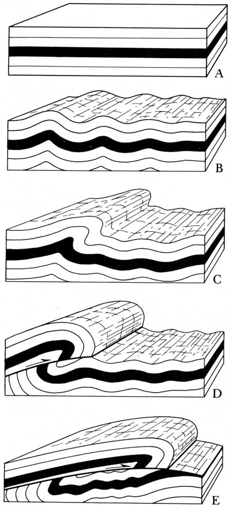
Strata: In geographical terms, strata can be defined as beds of rocks of a particular kind (usually sedimentary), comprising many uniform layers, that is formed naturally by materials that get deposited.
Stratosphere: Stratosphere is the part of the earth's atmosphere that is below the mesosphere and above the troposphere. It extends from 10km to 50km above the surface of the earth.
Stratovolcano: A steep-sided volcano built by lava flows and tephra deposits. (Also called composite volcano.)
Strip Cropping: where new crops are grown in narrow strips; the ploughed soil where seeds are to be planted is protected from erosion by adjacent strips where growing crops are at much later stages of growth.
Strip Farming: Strip farming is a technique of farming, where field crops are grown in alternate, narrow strips, following the contour of the land. This technique is used to reduce or prevent soil erosion.
Structure (of a population): the relative percentages of people of different age groups, usually shown on a population pyramid.
Structure of Trade: the differing proportions of primary, secondary and tertiary products that make up a country's exports and imports e.g. LEDCs export low-value raw materials and commodities and import high value machinery and consumer goods from MEDCs. See Single Product Economy.
Stump: formed by continuing wave action attacking a stack until it collapses.
Subcontract: where a large company, e.g. Nike, arranges for its goods to be produced by another company.
Subduction zone: The place where two lithospheric plates come together, one riding over the other. Most volcanoes on land occur parallel to and inland from the boundary between the two plates.
Sublimation: Sublimation is a term used to describe the changing of a solid into the gaseous state without going through the liquid phase.
Subsidies: this is money paid to farmers for producing certain crops, e.g. oil seed rape. They encourage the farmers to grow more of the subsidised crop making the EU more self-sufficient in many foodstuffs. But the drive to increase yields has led to:
Subsidy: a grant of money made by the government to industries locating in Development Areas; industries locating in South Wales receive a labour subsidy per worker, which encourages them to employ more people, reducing their costs and increasing profits.
Subsistence Farming: farming which uses simple technology, low capital investment, and in which the production of food for the individual farmer's family is the priority. There is often no food left to sell. Most farmers manage now to sell some of their output at some times during the year. (See Commercial farmingand Peasant farming).
Subsistence: Growing just enough food for your own needs with nothing left over to sell.
Suburb: An area of housing around the edge of a city.
Suburbanisation: the process by which people, factories, offices and shops move out from the central areas of cities and into the suburbs.
Suburbanised Villages/Towns: dormitory or commuter villages/towns with a residential population who sleep in the village/town but who travel to work in the nearby large urban area. The suburbanised village has increasingly adopted some of the characteristics (new housing estates, more services) of urban areas.
Suburbs: the outer zone of towns and cities.
Sunbelt: a growth region of high-tech industry in the south west of the USA.
Sunrise Industries: high -tech industries.
Sunrise Strip: a high-tech industrial zone following the route of the M4 westwards to South Wales.
Superimposed Drainage: Superimposed drainage is a drainage system that naturally evolved on a set of rocks, which were subsequently immersed by river incision. Therefore, the drainage system is unrelated to the rocks that it now lies on.
Surplus: too much of a product being produced.
Suspended Load: very small and light material, usually fine clay and silt, transported by the river in suspension.
Sustainable Agriculture: Sustainable agriculture is a method of farming that implements eco-friendly techniques of farming to ensure that the natural resources are not degraded. Sustainable agriculture also supports increased production of crops.
Sustainable Farming: farming which avoids soil erosion and pollution: it does not destroy the land for future generations.
Sustainable yield: The amount of a naturally self-reproducing community, such as trees or fish, which can be harvested without diminishing the ability of the community to sustain itself.
Swamp: As per geography definitions, a type of lowland that is seasonally flooded or waterlogged with stagnant water and has woody vegetation cover is known as a swamp.
Swash: Swash, in geographical terminology, is a term used to describe water from the break of a wave, moving up the shore or beach.
Swash: forward movement of a wave up a beach.
S-wave: A S-wave is defined as a type of seismic wave that carries rock particles in a direction that is perpendicular to the direction in which the wave itself is traveling. The S-wave is also known as the secondary wave or the shear wave.
Synoptic chart A weather chart reflecting the state of the atmosphere over a large area at a given moment.
Synoptic Chart: The synoptic chart is a type of weather map that indicates the atmospheric state of a large area at any given time.